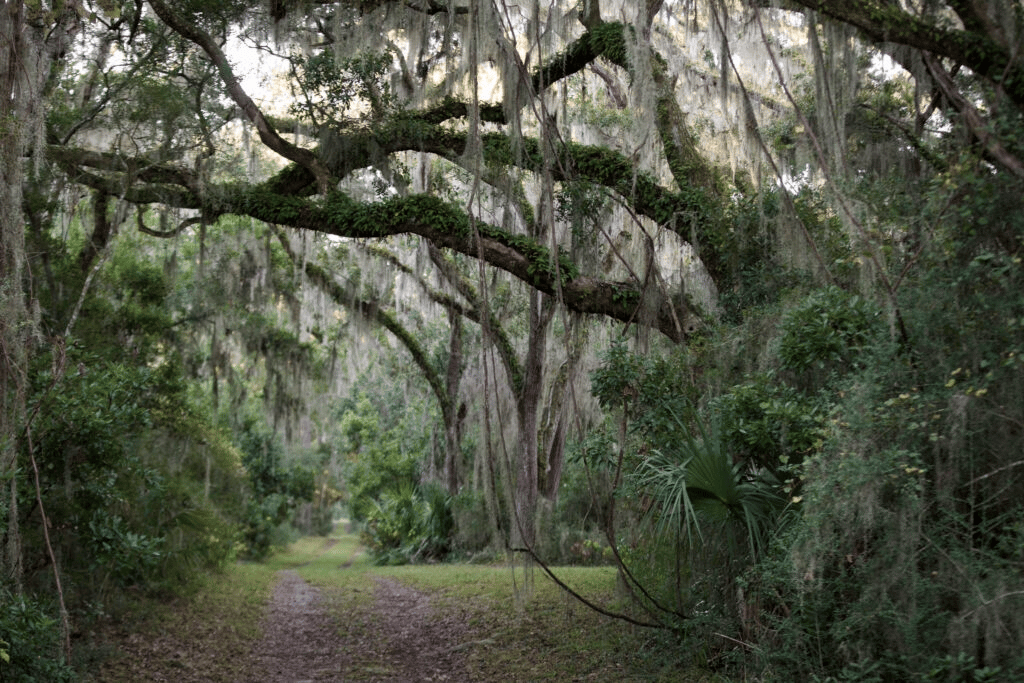
The Evidence Behind November's Sold-Out Cannon's Point Tours Sits on Free Public Trails
October 29, 2026
October 29, 2026
At the end of Cannon's Point Drive, past the turn off Lawrence Road, the old Taylor's Fish Camp on Lawrence Creek now has an education pavilion, a kayak launch, a small lab, an observation tower and restrooms. The prehistoric midden near the fish camp was excavated in the summer of 2018, and it produced more than 30,000 fragments of shell and bone.
Most of what makes Cannon's Point important to archaeologists looks like that midden: things people threw away, plus the outlines of where they slept. Nearly all of it lies on the 608-acre preserve the St. Simons Land Trust opens free of charge every Saturday, Sunday and Monday.
On Tuesday, November 17, the Coastal Georgia Historical Society opens this year's lecture series at St. Simons Presbyterian Church, 205 Kings Way. Dr. Jerald T. Milanich, Curator Emeritus at the Florida Museum of Natural History, will present "The 4,000-Year-Old History of Cannon's Point." His talk covers the University of Florida excavations of the 1970s, which ran for more than two years. It also covers the recent return of the Cannon's Point archaeological collections to the Society, which the Society describes as "fulfilling a vision first established more than fifty years ago." The Islander ran the announcement in early October.
The next morning, Dr. Milanich leads guided tours of the preserve itself.
Lecture | Field trips | |
|---|---|---|
Date | Tuesday, November 17 | Wednesday, November 18 |
Time | 6:00 to 7:30 p.m. | 9 a.m. or 1:30 p.m., about three hours each |
Place | St. Simons Presbyterian Church | Meets at Taylor's Fish Camp |
Cost | Free for members, $15 for non-members | $100 per person, transportation included |
Capacity | Registration online | Thirty participants per tour |
Seats on the field trips are sold out or close to it. The field trip page lists the morning tour as sold out with two seats left in the afternoon, and the lecture page calls both trips sold out. The Society says the tours visit several of the archaeological sites from the lecture with "the archaeologist who directed the landmark excavations." The Society also states plainly that the $100 fee buys none of the access. Cannon's Point Preserve is open to the public without charge Saturdays, Sundays and Mondays, 9 a.m. to 3 p.m.
A seat on that tour gets you Dr. Milanich's account of the excavations. Walking the ground yourself costs nothing.
Begin at Taylor's Fish Camp. Thomas Scott Clark's 2018 excavation there, completed as a master's project by 2019, studied what people ate during the Late Woodland period, which his thesis dates to roughly AD 700 to 1100. The diet centered on estuarine shellfish and fish. Fine-mesh screens recovered small fish that coarser screens would have let fall through, and the Land Trust's archaeology page calls out that detail on its own.
The restrooms have their own find. A 2016 dig at the restroom site turned up a Native American pot about 4,000 years old.
The southern area is the easiest part of the preserve to reach. The parking, bathrooms, Georgia Pacific Education Pavilion, dock and southern loop trail are all wheelchair accessible. If time is short, the area around the fish camp still puts you near the 2018 dig site.
The plantation ruins are farther out. The Land Trust puts the round trip to the Couper house ruins at about five miles, which takes most people about two hours on foot or 40 minutes by bike. The trails north of the southern area are not wheelchair accessible.
The preserve regulations and the FAQ set the terms:
The Land Trust suggests closed-toe shoes, bug spray, sunscreen and an eye on the sky, since coastal weather can change quickly.
John Couper and James Hamilton bought Cannon's Point in 1793. By 1804 Couper had built a larger house measuring 35.4 by 60 feet, with poured tabby basements above ground, a main floor, an upstairs and an attic with dormers. It burned in 1890, and the tabby ruins are open to visitors with interpretive signs.
The other stop on the walk is quieter and tells you more. The shared chimney from cabins of enslaved people also has an interpretive sign and is open to visitors. Each cabin was 40 by 20 feet and split into two homes of 20 by 20 feet. Each home had a sleeping loft, and the two homes shared a privy. Six to eight people lived in each home.
The overseer's house stood north of the southern community of enslaved people. It was larger than most overseers' houses, at a story and a half with two chimneys and four fireplaces, and it had a detached kitchen, a privy and a provision house.
Household | Footprint | Who lived there |
|---|---|---|
Couper main house | 35.4 x 60 ft, about 2,124 sq ft per floor, plus upstairs and attic | The planter's family |
Overseer's house | 34.1 x 36.1 ft, about 1,231 sq ft, story and a half | The overseer |
Half of a shared-chimney cabin | 20 x 20 ft, 400 sq ft, with sleeping loft | Six to eight enslaved people |
The University of Florida work in the 1970s was built around this comparison. John Solomon Otto's 1984 book set the material conditions of enslaved people, overseers and planters side by side. A historical archaeology synthesis published by the Georgia Department of Transportation calls it a pioneering study of social status in the archaeological record.
According to that synthesis, housing reflected social differences more clearly than anything else Otto measured. All three households used mostly English-made industrial ceramics. What separated them was the form of their dishes, teaware at one table and bowls at another, more than the type of pottery. The diets of enslaved people and overseers were remarkably similar. Otto read the property as racially divided while its material goods split more sharply between ownership and labor.
The preserve's history page describes how enslaved people at Cannon's Point fed themselves. Under the task system, they cultivated 200 to 300 acres of sea island cotton and 25 acres of food crops. After the day's assigned task was done, they hunted and fished to feed their families, because the planter did not provide a wide variety of food.
The lecture title covers 4,000 years, and the cotton era fills only a small part of it. The Land Trust dates the shell middens on the property to 2500 BCE and says there is significant evidence of prehistoric Native American villages on the preserve.
Two Late Archaic shell rings at Cannon's Point have been excavated, Marsh Ring and West Ring. In a 1995 University of Georgia synthesis, Marsh Ring's midden runs 1.75 meters deep with plain fiber-tempered pottery throughout. Its uncorrected radiocarbon dates are 4190±90 and 3765±90 years before present. The same report summarizes a faunal analysis showing that fish and crustaceans mattered more than mollusks in the Cannon's Point assemblage, even though the deposits are built of shell.
That result points the same way as Clark's fine-screen work at the fish camp thousands of years later. People here relied on the creek's fish as much as on its oysters. The Land Trust's public materials don't identify either named ring along a visitor trail, so look for the middens on the interpretive signage rather than expecting a marked ring.
Artifacts collected since the Land Trust bought the preserve in 2012 are curated with the Coastal Georgia Historical Society. The Society has run an archaeology laboratory at the Historic Coast Guard Station at East Beach since 2012. The late Dr. M. Ray Crook founded it to keep local collections in a local repository. It now curates more than 50 collections and tens of thousands of artifacts, and most of them come from Cannon's Point.
With the 1970s collections now back as well, the island holds one of its most thoroughly studied pieces of ground and most of what came out of it within a few miles of each other. The Society hasn't announced whether the returned material will go on display, so the November 17 lecture is the place to hear what is in it.
The preserve keeps its usual schedule through the fall, and three open stretches fall before the lecture:
Plan on a morning start. The gates close at 3 p.m., and the walk to the Couper ruins and back takes about two hours. Paddlers also need to be on the water before the launch closes at 1 p.m. If you visit the weekend after the lecture, you'll walk the same ground knowing what Dr. Milanich said about it. The Land Trust takes questions about the preserve at 912-638-9109.
Page Aiken is a seventh-generation St. Simons native, and he's glad to talk about the north end and the land along Lawrence Road with neighbors who care about what's preserved there. When you'd like to talk it over, Page Aiken is ready to start the conversation.
Stay up to date on the latest real estate trends.
A data-driven approach paired with international experience ensures every client benefits from a deeper understanding of market movement and opportunity.